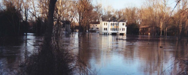
More and more property owners find themselves facing increased costs for flood insurance, especially those who have experienced damage from recent severe weather events. Flood maps are being reviewed and amended, and more sites are being impacted by changes in floodplain boundaries. Significant increases in insurance premiums are common, even with properties that may only be marginally affected. Hopewell Valley Engineering, PC is prepared to assist you.
The FEMA Elevation Certificate is the primary source of determining the relationship of your property to the flood hazard limits. It provides a means to document existing elevations of the property, and illustrate the relationship to the flood hazard limits depicted on the Flood Insurance Rate Map (FIRM). Utilizing this information provides documentation that could support reductions in premiums, or even eliminate the requirement for flood insurance by lenders.
Even if findings indicate a property falls outside the flood hazard area, it may still be appropriate to carry flood insurance. If you are near a flood prone area, you could still be at risk for flooding. Groundwater infiltration can be as great a problem as surface flows under certain conditions. An Elevation Certificate will aid you in assessing the risk, and taking appropriate action to protect you and your property.
Please call if you need help addressing this important issue.
About the Author

Russ Smith